top of page

Rabbit Ings Country Park Circular Walk

Updated: Aug 5


The White Shire Walk


Rabbit Ings Country Park Circular Walk – 3.63 Easy Miles with Parking Near Barnsley

Looking for an easy walk near Barnsley with convenient parking? Our 3.63-mile Rabbit Ings Country Park Circular Walk explores one of South Yorkshire's most impressive examples of a former industrial landscape transformed into a haven for wildlife and walking.

Lyn and I personally walked, photographed and GPS recorded this route for The White Shire. We found it to be a nice, easy and enjoyable walk and, at only 3.63 miles, it's a great option when you fancy getting outside without committing yourself to a long day of walking.

There's a car park at Rabbit Ings Country Park, which makes this another straightforward walk if you're arriving by car.

What makes Rabbit Ings particularly interesting, though, is its transformation. What is now a 64-hectare country park of grassland, woodland and wetland was once associated with coal mining.

Today, it's difficult to imagine just how industrial this peaceful landscape once was.


Rabbit Ings Country Park Walk at a Glance

Distance: 3.63 miles

Route type: Circular

Difficulty: Easy

Location: Rabbit Ings Country Park, near Royston

County: South Yorkshire

Area: Barnsley

Parking: Car park available at Rabbit Ings Country Park

Terrain: Maintained park paths, tracks, woodland trails and some gradients

Highlights: Panoramic views, woodland, wetlands, wildlife, mining heritage and the giant hillside rabbit

Dogs: Dogs are welcome in the country park

Walked and photographed by: Michael and Lyn Palmer, The White Shire


Parking at Rabbit Ings Country Park

There's a visitor car park at Rabbit Ings Country Park on Lund Hill Lane near Royston.

For Lyn and me, having parking at the start makes walks like this particularly convenient.

You can arrive, park up, put your walking boots on and get going.

The main car park has opening and closing times that vary through the year, so we'd recommend checking the current Rabbit Ings Country Park visitor information before travelling and always checking the signs when you arrive.

There is also a height barrier at the main car park.


About Our Rabbit Ings Country Park Walk

At just 3.63 miles, this is one of our shorter White Shire walks.

Lyn and I found it nice and easy.

There are some gradients within the park, but we didn't find the route particularly demanding.

What we particularly enjoyed was the variety.

You're not simply walking around one large field.

Rabbit Ings contains woodland, grassland, wetland areas, paths climbing through the landscape and some excellent views across the surrounding countryside.

For a relatively short walk, there's plenty to see.


Where is Rabbit Ings Country Park?

Rabbit Ings Country Park is situated on Lund Hill Lane near Royston in South Yorkshire.

It's approximately six kilometres north-east of Barnsley and sits within a landscape that combines former industrial land, countryside and neighbouring communities.

Despite being relatively close to Barnsley and Wakefield, parts of the park feel surprisingly open.

That's one of its great advantages.

You don't need to travel to one of Yorkshire's national parks to enjoy a few peaceful miles outdoors.


From Colliery to Country Park

The history of Rabbit Ings is very different from many of the Yorkshire landscapes Lyn and I explore.

This wasn't historically a grand country estate or an ancient woodland.

The modern country park was created on land associated with the former Monckton Colliery and later Royston Drift Mine.

Mining dominated this landscape.

Coal was extracted beneath the ground while spoil and industrial activity transformed the surface.

The mining operations eventually closed in 1989.

What happened afterwards is one of the most interesting parts of the Rabbit Ings story.


The South Yorkshire Coalfield

For generations, coal mining shaped communities around Barnsley.

Coal provided employment for thousands of people and supported industries far beyond Yorkshire.

Entire communities grew around collieries.

Railway lines carried coal away from the pits, while spoil heaps and industrial structures became familiar features of the landscape.

Royston was one of those mining communities.

The industry didn't simply provide jobs.

It influenced housing, transport, social life and the identity of generations of families.


When the Mines Closed

The closure of collieries throughout South Yorkshire brought enormous change.

Jobs disappeared.

Industrial sites became redundant.

Communities that had depended on mining for generations suddenly had to adapt.

The landscape also changed.

Pits closed and buildings were demolished.

Railway infrastructure disappeared or became disused.

Spoil heaps remained.

But those former industrial landscapes also created opportunities for something completely different.


Creating Rabbit Ings Country Park

The former mining landscape was gradually reclaimed.

Rather than disappearing beneath housing or another industrial development, the site was transformed into green space.

Rabbit Ings officially opened as a country park in 2011.

The Land Trust took over its management the following year.

Today, the park covers around 64 hectares.

That's quite a transformation.

A landscape once associated with coal extraction is now somewhere people come to walk, watch wildlife and enjoy the countryside.


A Landscape Designed for Wildlife

Rabbit Ings contains a mixture of habitats.

There are areas of grassland, woodland and wetland.

That variety is important.

Different species need different environments to feed, breed and find shelter.

The park also connects with other nearby semi-natural habitats, helping wildlife move through the wider landscape.

For Lyn and me, that's one of the most positive things about places like Rabbit Ings.

Industrial land hasn't simply been abandoned.

It's been given a completely new purpose.


The Giant Rabbit

One of Rabbit Ings' most unusual features is the enormous rabbit carved into the hillside.

It's difficult to miss once you know it's there.

The design was created with the involvement of 192 local schoolchildren and provides a distinctive landmark within the park.

The rabbit design has links with Norse imagery and the meaning behind the name Rabbit Ings.

It's a clever way of connecting the modern park with both its name and local community.


What Does 'Ings' Mean?

The word "ings" has Norse origins and is associated with low-lying wet ground or wetland.

You'll find similar place-name elements throughout Yorkshire.

Yorkshire's place names contain countless reminders of the Scandinavian settlers who influenced the county more than a thousand years ago.

So even the name Rabbit Ings tells us something about the landscape.

Wetland remains an important part of the park today.


Walking to the Higher Ground

Although we've rated our route easy, Rabbit Ings isn't completely flat.

Some of the paths climb through the park.

The reward is the view.

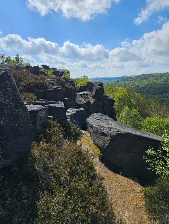
Higher parts of the site give you panoramic views across the surrounding South Yorkshire landscape.

This is where the site's industrial history becomes particularly interesting.

From the top, you're looking across communities and countryside once heavily shaped by mining.

Today, much of it looks remarkably green.


Big Views Across South Yorkshire

One of the advantages of a reclaimed spoil landscape is elevation.

Material brought up through mining created artificial high ground.

Once restored and landscaped, those higher areas can provide excellent viewpoints.

Rabbit Ings is a good example.

You don't need to climb a Yorkshire mountain to get a broad view across the surrounding landscape.

For a 3.63-mile easy walk, we think that's a pretty good return.


Woodland at Rabbit Ings

Woodland provides another change of atmosphere as you explore the park.

Trees and scrub have become established across parts of the former industrial site.

They provide valuable wildlife habitat while also making the walk more varied.

The woodland trails can be narrower and less surfaced than the main paths.

That's worth bearing in mind after prolonged wet weather.

But for us, the mixture of open views and more enclosed woodland is one of the reasons the walk remains interesting.


Wetland Habitat

The wetland areas are another important feature.

Ponds and damp habitats attract birds, insects and amphibians.

Water immediately adds another dimension to a country park.

It creates reflections, changes the vegetation and provides somewhere for wildlife to feed and breed.

The wetlands also connect nicely with the meaning behind the word "ings".

In that sense, the modern landscape has brought part of the site's historic identity back to life.


Wildlife at Rabbit Ings

Rabbit Ings supports a wide variety of wildlife.

The combination of grassland, woodland and wetlands creates opportunities for numerous species.

Birdlife is particularly noticeable.

Butterflies can also be seen across the grassland during the warmer months.

We don't pretend to be expert naturalists.

But Lyn and I always keep our eyes open while we're walking.

That's part of the enjoyment.

When you're walking rather than driving, you notice considerably more of what's happening around you.


Butterflies at Rabbit Ings

The grassland at Rabbit Ings provides habitat for several butterfly species.

Small Heath, Small Copper and Orange-tip are amongst the species recorded within the country park.

Butterflies are a good indicator of the variety of habitats present.

Different species depend on particular plants and environmental conditions.

It's another example of how successfully nature can return to former industrial land.


A Green Corridor

Rabbit Ings doesn't exist completely in isolation.

Nearby woodland, watercourses, former railway corridors and the Barnsley Canal create connections through the wider landscape.

These green corridors can be extremely important for wildlife.

Animals don't recognise the boundaries between individual parks.

Being able to move between habitats helps populations survive.

This makes Rabbit Ings part of a much larger network of green space around Royston and Barnsley.


Old Railways and Industrial Heritage

Railways were an essential part of South Yorkshire's coal industry.

Coal had to be transported from collieries to power stations, factories and other customers.

As mining disappeared, many of those railway lines became redundant.

Some have subsequently found a new purpose as walking and cycling routes.

It's one of the recurring themes Lyn and I find on our Yorkshire walks.

Routes once created for heavy industry have become some of the best traffic-free recreational paths.


The Barnsley Canal

The remains and route of the Barnsley Canal lie within the wider landscape around Rabbit Ings.

The canal was built to transport goods and coal during the Industrial Revolution.

Like the railway network, it became part of the infrastructure that allowed South Yorkshire's industries to expand.

Sections of the old canal landscape now contribute to walking routes and wildlife corridors.

Again, the purpose of the landscape has changed completely.


Walking Around Rabbit Ings

The park contains an extensive network of maintained footpaths.

The main routes are generally wide, although some of the woodland trails are narrower and unsurfaced.

There are also gradients within the park.

Lyn and I found our particular 3.63-mile route easy, but we'd still recommend suitable footwear.

Weather can change any outdoor route.

After prolonged rain, less surfaced sections may naturally be wetter or muddier.


Is the Rabbit Ings Walk Difficult?

We found it easy.

Our route measures 3.63 miles and we didn't encounter anything we'd describe as particularly difficult.

There are some gradients, so "easy" doesn't mean completely flat.

But based on our own experience, we'd definitely place this amongst our easier White Shire walks.

It's a nice option if you want something relatively short but still want enough variety to make the walk interesting.


How Long is the Rabbit Ings Country Park Walk?

Our GPS-recorded Rabbit Ings route measures approximately 3.63 miles.

How long you'll need depends on your own pace and how often you stop.

Lyn and I don't rush our walks.

We're taking photographs, looking at the landscape and generally seeing what we can discover.

And Rabbit Ings is somewhere worth looking around.

The views, wildlife and history all deserve more attention than simply trying to complete the mileage as quickly as possible.


Is There a Car Park at Rabbit Ings?

Yes.

Rabbit Ings Country Park has a visitor car park off Lund Hill Lane.

The car park makes it a convenient starting point for our circular walk.

Current visitor information also lists an alternative smaller parking area further along Lund Hill Lane.

Because opening times and parking arrangements can change, we'd recommend checking the latest visitor information before travelling and reading the signs when you arrive.


Are Dogs Allowed at Rabbit Ings?

Yes, dogs are welcome at Rabbit Ings Country Park.

As with any shared public space, we'd expect dog owners to behave responsibly and follow any signs or requests in place at the park.

The combination of paths, open areas and woodland helps make Rabbit Ings a popular place for local dog walking.


Is Rabbit Ings Good for Walking?

Yes.

We think it's particularly good if you're looking for a relatively easy walk around Barnsley.

You have a network of paths, varied habitats and some excellent elevated views.

There's also enough history to make the landscape interesting.

Knowing that you're walking across a former mining site completely changes how you see the park.


Is Rabbit Ings Country Park Worth Visiting?

We think it is.

Rabbit Ings isn't about historic castles or grand country houses.

Its story is completely different.

This is about regeneration.

It's about taking a landscape once dominated by mining and turning it into somewhere people and wildlife can enjoy.

For us, that's every bit as much a part of Yorkshire's story as its medieval abbeys and stately homes.


Is Rabbit Ings Suitable for Families?

Rabbit Ings is a public country park with an extensive network of walking paths.

Our own 3.63-mile route was easy based on Lyn's and my experience.

Whether the complete route is suitable for your family naturally depends on individual ability, weather and conditions on the day.

Because some paths have gradients and narrower woodland sections, we'd recommend checking the current accessibility information if you have particular mobility requirements.


When is the Best Time to Walk at Rabbit Ings?

We'd consider Rabbit Ings throughout the year.

Spring brings fresh growth and increasing wildlife activity.

Summer is particularly good for butterflies and gives you longer daylight hours.

Autumn changes the woodland and grassland colours.

Winter opens up views through the trees and gives the park a completely different character.

The car park operates seasonal opening times, so that's something we'd check before setting off.


What Else Can You Explore Nearby?

Royston is immediately nearby, while Barnsley is only a few miles away.

The wider Dearne Valley contains numerous examples of former industrial landscapes that have been regenerated for nature and recreation.

If you enjoy this type of walk, our Dearne Valley Park route is another good option.

You can also explore more of the countryside around Barnsley, Wakefield and Doncaster.

See what's on in South Yorkshire for events, shows, festivals and other ideas for a day out.


Explore More of South Yorkshire

If you've enjoyed discovering Rabbit Ings, there are plenty more places to explore with us around South Yorkshire.

Discover more South Yorkshire circular walks and find another route personally walked, photographed and GPS recorded by Michael and Lyn.

Or explore our complete collection of Yorkshire walks, covering routes across South, West, North and East Yorkshire.


About Michael and Lyn

Michael and Lyn Palmer explore Yorkshire together on foot, personally walking, photographing and GPS recording the routes featured on The White Shire.

Our walking guides combine first-hand experience with practical route information, local history and the character of the places we discover along the way.

We're not professional hikers – we simply enjoy getting out together, finding somewhere interesting to walk and discovering more of Yorkshire as we go.

Rabbit Ings is a great example – a nice, easy 3.63-mile walk with parking, wildlife, woodland, wetlands and some surprisingly good views across South Yorkshire.


Rabbit Ings Country Park Circular Walk

View our GPS-recorded 3.63-mile Rabbit Ings Country Park Circular Walk below and use it to help plan your own visit.

Based on our experience, Lyn and I would rate this as an easy walk.

There's parking at the country park, which makes getting started straightforward, although we'd check the latest car park opening times before travelling.

Take your time as you climb through the park and enjoy the views from the higher ground.

And while you're walking through the grassland, woodland and wetlands, remember what was here before.

The peaceful country park you're exploring today was once part of South Yorkshire's coal-mining landscape.

That's quite a transformation.


Rabbit Ings Country Park

Comments


bottom of page