Slaithwaite to Marsden Canal Walk
- Michael Palmer

- Apr 8, 2023
- 8 min read
Updated: 6 days ago
Slaithwaite to Marsden Canal Walk – 6.62 Easy Miles in West Yorkshire
Looking for an easy canal walk in West Yorkshire with impressive Pennine scenery and plenty of industrial history along the way? Our 6.62-mile Slaithwaite to Marsden Canal Walk follows the Huddersfield Narrow Canal through the Colne Valley towards Marsden and the famous Standedge Tunnel.
Lyn and I personally walked, photographed and GPS recorded this route for The White Shire.
We rate it as an easy walk.
At 6.62 miles, it’s a decent distance, but we found the walking itself straightforward. Following the canal means there are no major climbs to tackle, leaving us free to enjoy the scenery, old mills, locks and reminders of the valley’s industrial past.
This is one of those walks where the surroundings gradually change as you go. Slaithwaite has a busy village feel, but as we head towards Marsden, the Pennine landscape increasingly takes over.
And waiting towards the far end is one of Yorkshire’s most remarkable pieces of canal engineering – Standedge Tunnel.
Slaithwaite to Marsden Canal Walk at a Glance
Distance: 6.62 miles
Route type: Canal walk
Difficulty: Easy – based on our experience
Location: Slaithwaite to Marsden
County: West Yorkshire
Area: Colne Valley
Nearby: Huddersfield, Marsden and Meltham
Terrain: Canal towpaths, surfaced paths and tracks
Highlights: Huddersfield Narrow Canal, Slaithwaite, Marsden, locks, old mills, Pennine scenery and Standedge Tunnel
Walked and photographed by: Michael and Lyn Palmer, The White Shire
Our Slaithwaite to Marsden Walk
Lyn and I really enjoyed this one.
At 6.62 miles, you certainly feel as though you’ve had a decent walk, but we didn’t find the route particularly demanding.
That’s one of the reasons we enjoy canal walking.
You can cover a reasonable distance without constantly climbing hills, while the canal itself gives you something to follow throughout much of the route.
But this certainly isn’t a boring towpath walk.
There’s plenty happening around you.
Locks, bridges, old mills and industrial buildings provide reminders of the Colne Valley’s past, while the hills surrounding Marsden give the walk a much more rural Pennine feel as you progress.
Starting in Slaithwaite
Slaithwaite – usually pronounced “Slawit” locally – sits in the Colne Valley between Huddersfield and Marsden.
It’s a place shaped heavily by the textile industry.
The combination of flowing water, transport connections and a growing workforce helped turn settlements throughout this valley into important manufacturing communities.
Today, Slaithwaite has a very different character.
Old industrial buildings survive alongside independent businesses, cafés and homes, while the Huddersfield Narrow Canal runs straight through the village.
For Lyn and me, it makes an interesting starting point because we immediately have the canal and industrial history around us.
Following the Huddersfield Narrow Canal
The Huddersfield Narrow Canal provides the backbone of this walk.
Today, following a canal through the Pennines sounds like a peaceful way to spend a few hours.
Originally, however, this was serious transport infrastructure.
The canal was constructed to create a navigable route across the Pennines, connecting Huddersfield with Ashton-under-Lyne and ultimately linking Yorkshire with Lancashire.
That meant overcoming one fairly substantial obstacle.
The Pennines.
The solution was Standedge Tunnel.
Walking Through the Colne Valley
One of the things we liked about this route was the way the scenery changed.
Around Slaithwaite, there are plenty of reminders that this was once a heavily industrialised valley.
As we continued towards Marsden, the surrounding hills became increasingly prominent.
That contrast makes the walk interesting.
We’re following a man-made waterway created for industry while being surrounded by a landscape that feels increasingly rural.
For us, this is Yorkshire at its best.
History and countryside aren't separated from one another.
They're part of the same landscape.
Those Old Yorkshire Mills
Anyone who has read a few of our White Shire walks will probably know that I have a bit of a soft spot for old industrial buildings.
And this walk certainly delivers.
The Colne Valley became heavily associated with woollen textile production, and mills once dominated parts of the landscape.
Some have disappeared.
Others survive but have completely different uses today.
I enjoy seeing them.
They might not be everyone's idea of beautiful Yorkshire architecture, but they're an important part of the county's story.
The Yorkshire Dales and moors show us one side of Yorkshire.
Old stone mills, canals and industrial valleys show us another.
Both belong here.
Locks, Bridges and Canal Engineering
There's more to a canal than simply water and a towpath.
As Lyn and I walk, there are locks, bridges, retaining walls and other structures that remind us how much engineering went into creating these waterways.
Remember, this canal had to climb through the Pennine landscape.
That required a whole sequence of locks to raise and lower boats as they travelled through the valley.
Walking beside them today, it's easy to forget that they were constructed to move working boats carrying commercial cargo rather than people out enjoying an afternoon stroll.
Arriving at Marsden
Marsden has a different feel from Slaithwaite.
We're now much deeper into the Pennine landscape, with hills surrounding the village and the canal heading towards Standedge.
Marsden itself is worth taking some time to explore.
Like Slaithwaite, it developed around the textile industry, but its position close to the Pennine watershed gives it a particularly distinctive setting.
For us, though, there's one landmark that dominates this end of the walk.
Standedge Tunnel.
Standedge Canal Tunnel
Standedge Tunnel carries the Huddersfield Narrow Canal beneath the Pennines between Marsden and Diggle.
At more than three miles long, it's an extraordinary achievement of early canal engineering.
Standing near the entrance and looking towards the hillside, it's quite difficult to imagine a canal disappearing underneath the Pennines for several miles.
But that's exactly what happens.
For Lyn and me, places like this are what turn an enjoyable walk into something much more memorable.
We're not simply following a canal.
We're following a route created by engineers determined to find a way through one of the biggest natural barriers between Yorkshire and Lancashire.
Why Standedge is So Impressive
Building a canal tunnel through the Pennines would be an enormous project today.
Imagine attempting it more than two centuries ago.
The work was difficult, dangerous and expensive, but the tunnel eventually allowed boats to travel beneath the Pennine watershed rather than having to find another route around it.
Today, Standedge has become one of the best-known landmarks on the Huddersfield Narrow Canal.
If you're interested in Yorkshire's canals and industrial history, it's well worth spending some extra time around Marsden rather than simply turning around and heading back.
Industrial Yorkshire Meets the Pennines
For me, this is probably the strongest feature of the entire walk.
On one side, we've got the landscape.
Hills, water and open Pennine scenery.
On the other, we've got what people built into that landscape.
Mills.
Locks.
Bridges.
The canal.
And finally a tunnel straight through the hills.
The two stories are completely intertwined.
It's also why walks like this fit The White Shire so well.
Lyn and I enjoy the countryside, but we're equally interested in finding out why places look the way they do and what happened there before us.
Is the Slaithwaite to Marsden Canal Walk Difficult?
Based on our experience, no.
Lyn and I rate our 6.62-mile Slaithwaite to Marsden Canal Walk as easy.
The main consideration is the distance rather than difficult terrain.
At over six and a half miles, you'll obviously be walking for a few hours, but following the canal keeps things relatively straightforward.
We didn't encounter the prolonged steep climbs you'd find on many Pennine walks.
Conditions can naturally change with the weather, and towpaths may be wet or muddy in places after prolonged rain.
Suitable walking footwear is always sensible.
Is This Walk Suitable for Beginners?
If you're comfortable walking more than six miles, we think it could be.
The terrain is generally less demanding than many walks of a similar distance because you're following the canal rather than repeatedly climbing hills.
If you're completely new to walking, we'd probably start with one of our shorter three or four-mile White Shire routes first.
We've personally walked routes of different lengths and difficulties throughout Yorkshire, so there are plenty to choose from.
How Long is the Slaithwaite to Marsden Walk?
Our GPS-recorded Slaithwaite to Marsden Canal Walk measures 6.62 miles. (The White Shire)
How long you'll need depends on your pace and how often you stop.
Lyn and I don't rush.
We're usually taking photographs, looking at buildings and stopping whenever something catches our attention.
And there's plenty to stop for on this route.
Old mills.
Locks.
Canal structures.
Marsden.
And, of course, Standedge Tunnel.
For us, those things are part of the walk rather than distractions from it.
When is the Best Time to Walk Slaithwaite to Marsden?
We'd consider this route throughout much of the year.
Spring and summer bring longer daylight hours and greener surroundings.
Autumn can be particularly attractive as the colours change through the valley.
Winter gives the landscape a completely different Pennine character, although wetter weather can naturally make the towpath less pleasant underfoot.
As always with Yorkshire walking, we'd check the weather before setting off.
The conditions on the hills around Marsden can feel very different from those lower down the valley.
Discover More West Yorkshire Walks
If you enjoy this route, The White Shire has plenty more personally walked routes throughout West Yorkshire.
Lyn and I have explored canals, reservoirs, villages, woodland, historic towns and open countryside across the county.
Some are short and easy.
Others take us further into the Pennines and involve more climbing.
That's what we're gradually building The White Shire into – a place where you can discover one Yorkshire walk and then easily find another for next weekend.
Explore Yorkshire with The White Shire
Our walks are only one part of The White Shire.
Lyn and I are building the website around exploring Yorkshire – the places we visit, the walks we complete and the things we discover along the way.
So if you've found us because you were searching for a Slaithwaite or Marsden walk, have a look around the rest of the site before you leave.
You might arrive looking for a canal walk and end up discovering somewhere completely different for your next Yorkshire day out.
About Michael and Lyn
Michael and Lyn Palmer explore Yorkshire together on foot, personally walking, photographing and GPS recording the routes featured on The White Shire.
Our guides are based on our own experiences and combine practical walking information with some of the history and character of the places we discover.
We're not professional hikers.
We're simply a husband and wife who enjoy getting out together, finding interesting places and learning more about Yorkshire as we go.
And this route has plenty of what we enjoy – water, countryside, industrial history and some impressive engineering.
Slaithwaite to Marsden Canal Walk – Our Verdict
Our GPS-recorded Slaithwaite to Marsden Canal Walk measures 6.62 miles.
Lyn and I rate it as easy.
Despite being over six miles, we found the walking straightforward, with the Huddersfield Narrow Canal providing an easy route through the Colne Valley towards Marsden.
What makes it stand out is everything around the canal.
The old mills and industrial buildings tell the story of the valley's textile past, while the surrounding hills remind us that we're heading deeper into the Pennines.
Then there's Standedge Tunnel.
Seeing a canal disappear beneath the Pennines for more than three miles is a pretty impressive way to round off a Yorkshire walk.
For us, this is another great example of what The White Shire is about – getting out together, walking Yorkshire and discovering the stories behind the landscape as we go.
Slaithewaite-The White Shire-1 Slaithewaite-The White Shire-2 Slaithewaite-The White Shire-3 Slaithewaite-The White Shire-4 Slaithewaite-The White Shire-5 Slaithewaite-The White Shire-6 Slaithewaite-The White Shire-7 Slaithewaite-The White Shire-8 Slaithewaite-The White Shire-9 SlaithewaiteThe White Shire-10 SlaithewaiteThe White Shire-11 SlaithewaiteThe White Shire-12 
SlaithewaiteThe White Shire-13 
SlaithewaiteThe White Shire-14 
SlaithewaiteThe White Shire-15 
SlaithewaiteThe White Shire-16 
SlaithewaiteThe White Shire-17 
SlaithewaiteThe White Shire-18 
SlaithewaiteThe White Shire-19 
SlaithewaiteThe White Shire-20 
SlaithewaiteThe White Shire-21 
SlaithewaiteThe White Shire-22 
SlaithewaiteThe White Shire-23 
SlaithewaiteThe White Shire-24 
SlaithewaiteThe White Shire-25 
SlaithewaiteThe White Shire-26 
SlaithewaiteThe White Shire-27 
SlaithewaiteThe White Shire-28 
SlaithewaiteThe White Shire-29 
SlaithewaiteThe White Shire-30 
SlaithewaiteThe White Shire-31 
SlaithewaiteThe White Shire-32 
SlaithewaiteThe White Shire-33 
SlaithewaiteThe White Shire-34 
SlaithewaiteThe White Shire-35 
SlaithewaiteThe White Shire-36 
SlaithewaiteThe White Shire-37 
SlaithewaiteThe White Shire-38 
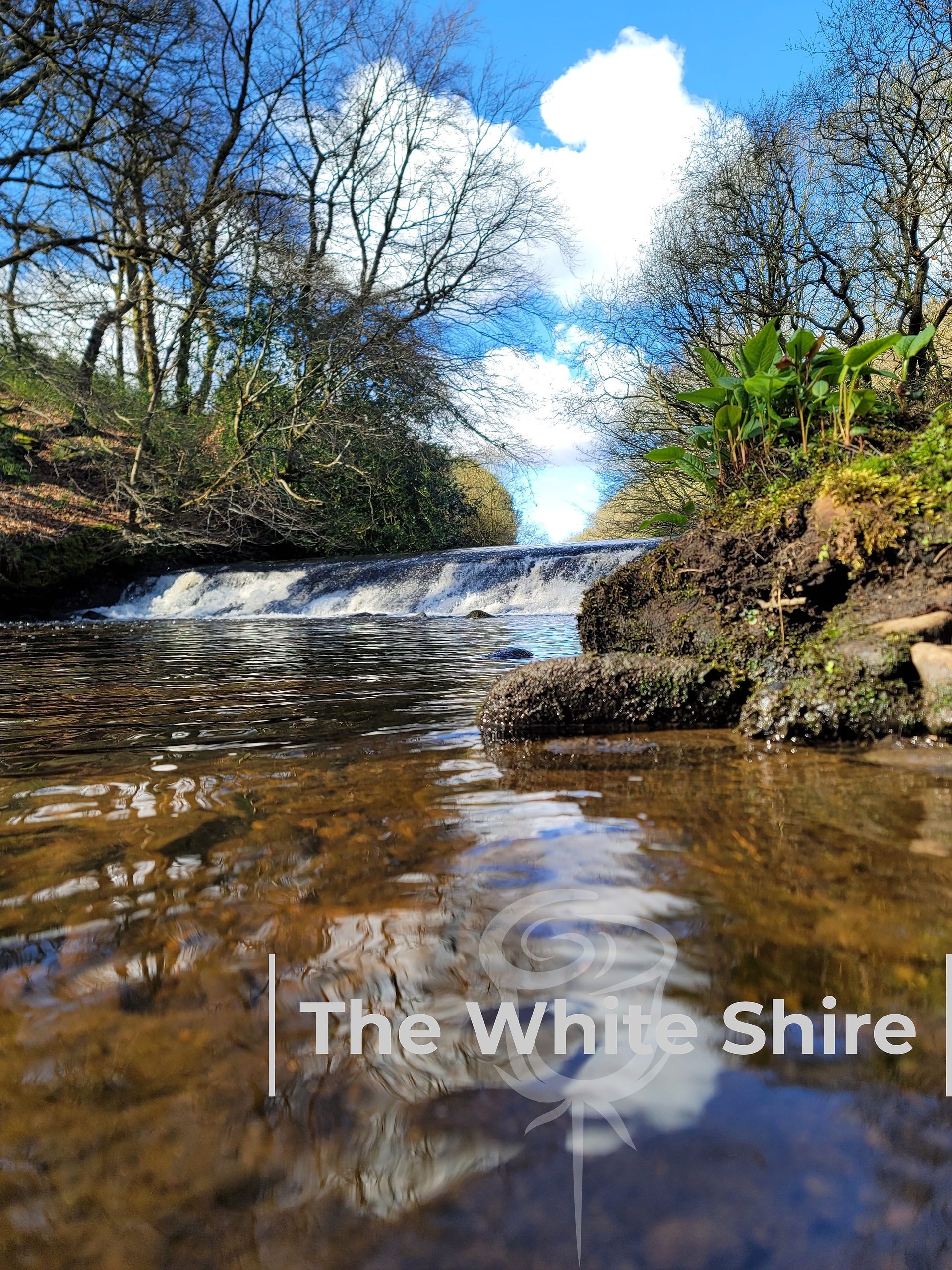
SlaithewaiteThe White Shire-39 
SlaithewaiteThe White Shire-40 
SlaithewaiteThe White Shire-41 
SlaithewaiteThe White Shire-42 
SlaithewaiteThe White Shire-43 
SlaithewaiteThe White Shire-44 
SlaithewaiteThe White Shire-45


Comments